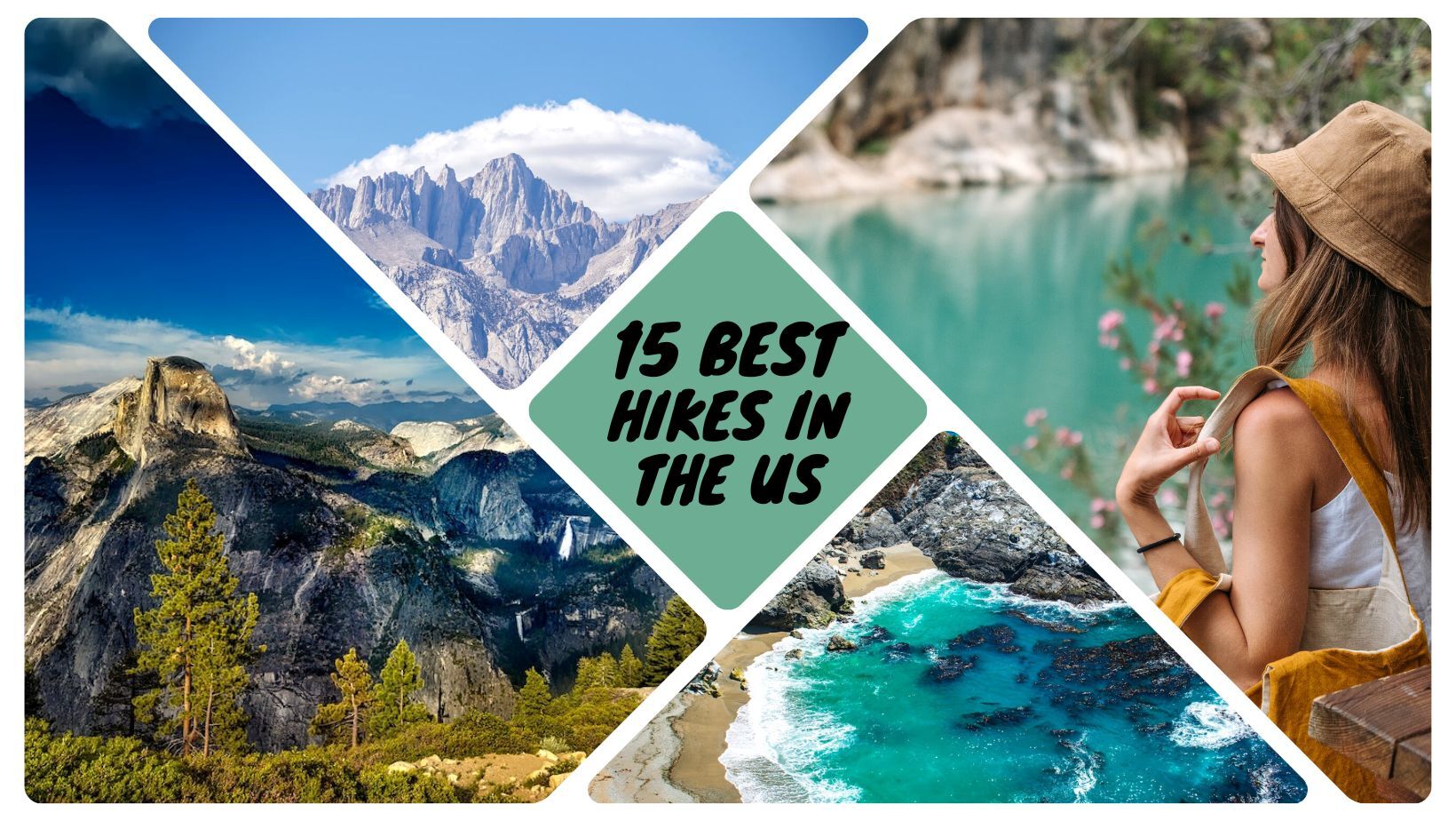
There are endless possibilities regarding hiking trails in the United States. Whether you’re a first-timer or an experienced hiker, there is something for everyone. This list has something for everyone, from popular and well-known trails to lesser-known hidden gems. You would love the 15 best hikes in the US!
The 15 Best Hikes in the US
So get outdoors and explore:
1. Appalachian Trail
The Appalachian National Scenic Trail is a footpath that’s about 2,190 miles long. It’s the longest hiking-only footpath in the world.
The Appalachian Trail is a long and popular hiking trail that runs through 14 states. Hikers will see stunning views of the Appalachian Mountains, forests, and rivers along the way. The Appalachian Trail is also home to a variety of wildlife. Hikers can see bears, deer, snakes, and birds along the trail. The trail also passes through various small towns, providing a chance to rest and resupply.
It is a popular destination for both day hikers and backpackers. The Appalachian Trail offers something for everyone. There are manageable sections for beginner hikers and challenging sections for experienced hikers.
While hiking the Appalachian Trail is a challenging endeavor, it’s also an incredibly rewarding one. Those lucky enough to complete the journey often say it’s a life-changing experience. The Appalachian Trail is a unique experience that should be noticed.
What is the estimated time to complete the Appalachian Trail?
The average hiker takes between five and seven months to complete the AT, hiking 14 to 20 miles daily.
How challenging is it to hike the Appalachian Trail?
To Hike the Appalachian Trail is a challenging task. It takes a lot of preparation and resilience to hike this entire trail.
What is the hardest part of the Appalachian Trail?
The most challenging part of the Appalachian Trail is the ascent up Katahdin. This mountain features more than 4,000 feet of elevation gain, making it the most significant sustained ascent on the trail. Scrambling to the summit can be difficult, so be prepared to use your hands as you climb steep boulders and ledges.
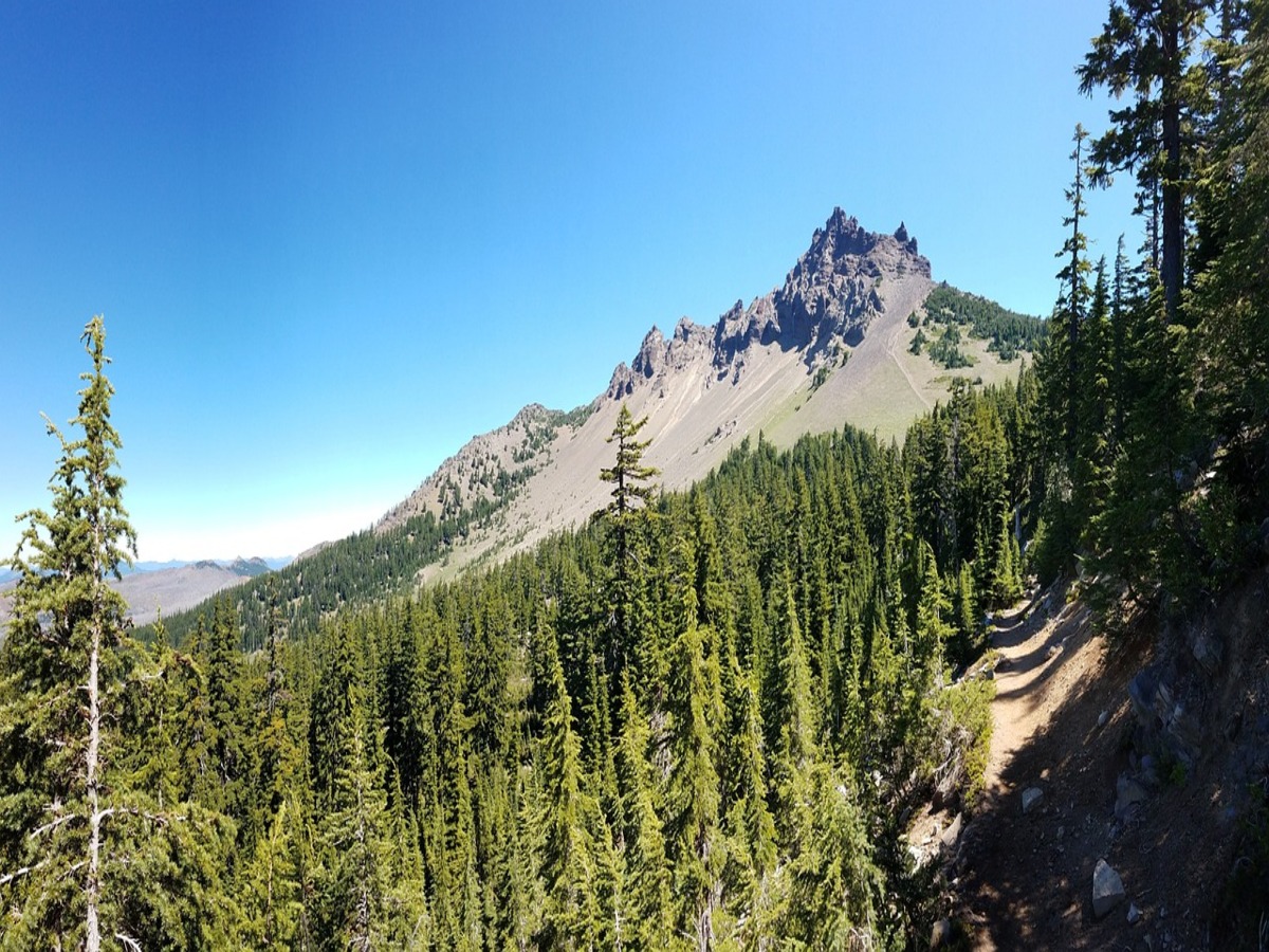
2. Pacific Crest Trail
The PCT is a long trail that stretches across the United States. It was officially completed in 1993.
The Pacific Crest Trail is another popular option for hikers looking for an extended adventure. Stretching 2,650 miles from Mexico to Canada, it is one of the world’s most popular and longest hiking trails. Like the Appalachian Trail, it offers hikers breathtaking views and a sense of accomplishment. The two trails have some similarities, but there are also some critical differences between them:
- The Pacific Crest Trail is much more remote than the Appalachian Trail.
- The terrain on the Pacific Crest Trail is more varied, including everything from deserts to mountains.
- The Pacific Crest Trail weather is more extreme, with colder winters and hotter summers.
For these reasons, hikers need to be better prepared before undertaking a hike on the Pacific Crest Trail. However, a hike on the Pacific Crest Trail can be an unforgettable experience with proper planning and preparation.
Can a beginner backpacker hike the Pacific Crest Trail?
While the Pacific Crest Trail offers opportunities for experienced hikers. It can also be enjoyed by beginner backpackers willing to take it slow. Most of the trail can be completed with a permit designated for hikes that are 500 miles or less in length, and those permits can generally be obtained at the trailhead for free or at a nominal cost.
What is the hardest part of the Pacific Crest Trail?
The ascent out of Hauser Canyon is often cited as one of the most challenging parts of the Pacific Crest Trail because it is typically the first day.
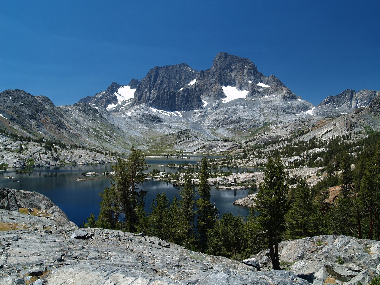
3. John Muir Trail
How long: 211 miles
The John Muir Trail is a challenging route, taking an average of 106 h 13 min to complete. This area is famous for backpacking, camping, and hiking, so you’ll likely encounter other people while exploring. The best times to visit this trail are May through October.
The John Muir Trail is considered part of the most favorite hiking trails in the United States. Hikers can expect stunning mountain views, pristine forests, and crystal-clear lakes. The trail is typically completed in 106 hours. Although there is no rush to finish it – many hikers take their time and enjoy the experience of being in nature.
The best times to hike the John Muir Trail are from May to October when the weather is mild and the days are long. While the trail is open to everyone, it is essential to be prepared before embarking on such a long journey. Hikers should have enough food and water, appropriate clothing, and a trail map. With proper preparation, hiking the John Muir Trail can be an unforgettable experience.
Do you need a permit to make the John Muir Trail?
You’ll need a wilderness permit to hike the John Muir Trail.
Do you require an ice axe on the JMT if the snowpack depth is low?
You will want to consider bringing ice axes and microspikes for travel across snowy and icy sections. The snowpack depth will influence water sources and their availability throughout the summer.
4. Wonderland Trail
How long: 93 miles
It takes 10 to 14 days to hike the entire Wonderland Trail, depending on your daily average. This trail has elevation gains and losses of over 3,500 feet daily, so be prepared for a challenging hike.
The trail passes through old-growth forests, alpine meadows, and along the edges of glacial valleys, providing hikers with stunning views of the mountain. Wonderland Trail is considered one of the ideal hikes in the United States. It is a popular destination for both day hikers and backpacking enthusiasts. The trail can be completed in as little as ten days, but most hikers take 2-3 weeks to complete the entire loop. Wonderland Trail is open to hikers from late June to early October, depending on snow conditions.
Do you need a permit to hike the Wonderland Trail?
You do not require a permit if you are hiking the Wonderland Trail. However, you must apply for a permit if you plan an overnight trip on the trail. The permits are usually in high demand, so it’s highly recommended that you apply for your itinerary as soon as possible.
Are there bears on Wonderland Trail?
You most probably will see bears while hiking on the Wonderland Trail. The trail goes through many different types of ecosystems, including areas where bears live. You may catch a glimpse of this beautiful wildlife, like mountain goats, lions, or bears.
5. New Hampshire’s White Mountains
How long: 60 miles
New Hampshire is known for its rich history as a center of the American Revolution, its awe-inspiring natural landscapes, and its lively culture and art scenes.
New Hampshire’s White Mountains are a true natural wonder, and visitors from all over come to hike and explore the area. The mountains offer amazing views and plenty of hiking and fishing opportunities. The White Mountains offer everything, from easy walking trails to challenging climbs. And in addition to the breathtaking scenery, the White Mountains are also home to various wildlife, including black bears, moose, and bald eagles.
Moreover, New Hampshire is home to many other attractions, such as the Mt. Washington Auto Road and the Kancamagus Highway. So if you’re looking for a day trip or a week-long adventure, New Hampshire’s White Mountains are a great place to visit for anyone who wants to experience all that nature has to offer.
What towns are near the White Mountains in New Hampshire?
New Hampshire’s White Mountains are a popular destination for hikers, campers, and other outdoor enthusiasts. The town of Lincoln is a good base camp for exploring the area, with various hiking trails and scenic views. Visitors can also enjoy the many shops and restaurants in the town center. For those looking to avoid crowds, the town of Bartlett is a great option. With its beautiful views, this small town is a great place to enjoy hiking.
Bartlett also has several bed and breakfasts, perfect for a relaxing getaway. Finally, no trip to the White Mountains would be complete without spending time in Conway. This quaint town is located on the scenic Kancamagus Highway and is the center of various shops and restaurants. Conway is also a great place to enjoy some New Hampshire history, with several historic buildings and museums in the town center.
What is the most challenging trail in the White Mountains?
The most challenging hiking trail in the White Mountains is considered to be the Huntington Ravine Trail.
6. The Presidential Range in New Hampshire’s White Mountains
What mountains make up the Presidential Range in NH?
How long: 20 miles
The Presidential Range in New Hampshire’s White Mountains is a mountain range of 7 peaks: Mount Madison, Mount Adams, Mount Jefferson, Mount Washington, Mount Monroe, Mount Eisenhower, and Mount Pierce. It is the highest elevation ridge in the state.
The Presidential Range, New Hampshire’s White Mountains, is a top-rated travel destination in the Northeast. Every year, thousands of people come to hike, ski, and enjoy the incredible views. If you’re planning a trip to the Presidents, here are a few things to remember:
- Be sure to pack plenty of food and water. The mountains are beautiful but strenuous, and you’ll need to keep your energy up.
- Travel with friends or let someone know where you’re going. The terrain can be challenging, and it’s always best to have someone watching your back.
- Remember that adventure awaits you around every corner.
The Presidents are full of surprises, so be prepared for anything! Thanks for reading, and safe travels.
What mountains make up the Presidential Range in NH?
The Presidential Traverse is an impressive 19-mile trek through the White Mountains of New Hampshire, boasting seven incredible summits: Mount Madison, Mount Adams, Mount Jefferson, Mount Washington (the highest mountain in the Northeast!), Mount Monroe, Mount Eisenhower, finally ending at the top of Mount Pierce. This rugged traverse is famed for its wild beauty and difficulty – traversers must battle cold temperatures and high winds while scaling each mountain.
As no technical climbing is required, the Presidential Traverse can be attempted by hikers of all levels; however, you should be aware of the challenge! The views from atop each summit are breathtaking and reward any weary travelers who make it to the end. Those who conquer this traverse will be rewarded with a deep sense of accomplishment, having conquered some of the most rugged terrains in New England.
7. Mount Washington
How long: 1.2 miles
Mount Washington is most well-known for its severe weather conditions.
The highest wind speed man has ever observed was 231 miles per hour. The Mount Washington Observatory recorded the temperature on April 12, 1934.
Mount Washington is the perfect destination for those looking to adventure with their friends. Although it is only 1.2 miles long, Mount Washington is most well-known for its severe weather conditions. However, this only adds to the excitement of the travel experience. With proper preparation, travelers can safely explore all Mount Washington offers. Many activities keep everyone entertained, from hiking and camping to fishing and climbing. So why not pack your bags and head to Mount Washington for your next vacation?
Is Mt. Washington the coldest place on Earth?
The frigid Mount Washington Observatory, tucked away in the White Mountains of New Hampshire, is renowned for its bitterly cold temperatures. On record, it has been measured at an unfathomable minus 36 degrees Celsius and with a wind chill of 94 degrees below zero – making it a close runner-up to the title of the world’s coldest place on Earth. It is an extreme climate that few have the bravery to experience first-hand.
Those brave enough to venture up the 6,288-foot summit will be met by icy winds that gust up to 200 miles per hour and deep snow drifts which can reach over 40 feet in height. Severe conditions such as these mean that even typical winter clothing offers no protection from hypothermia, frostbite, or other dangers.
Despite this, researchers from across the globe are drawn to Mount Washington Observatory every year as they attempt to unlock some of its secrets about Earth’s most extreme climates.
Can a beginner climb Mt Washington?
Exploring the summit of Mt. Washington can be an exhilarating experience that requires plenty of knowledge, practice, and preparation; however, even beginners can still enjoy the beauty and grandeur of this peak. Numerous lower-elevation points have spectacular views of the mountain’s summit for those new to hiking and mountaineering.
Square Ledge in Pinkham Notch is a great spot for novice adventurers who wish to take in one of the most iconic vistas in New England. From here, hikers can observe Mt. Washington’s rugged terrain, exposed ridges, and deep valleys from a safe distance. The elevation at Square Ledge is only 1,550 feet compared to Mt. Washington’s 6,288-foot peak. This makes it much easier for inexperienced climbers to admire the same sights that more advanced hikers experience at a higher altitude – without sacrificing their safety or comfort level.
8. Acadia National Park, Maine
How long: 27
Acadia National Park is an attractive place with stunning natural scenery. It’s well worth a visit if you’re ever in the area. What makes Acadia National Park so unique is its location – it’s the first national park east of the Mississippi River. Visitors can enjoy hiking, biking, camping, and the park’s beautiful views of the coastlines and lakes.
What is the best time of year to visit Acadia National Park?
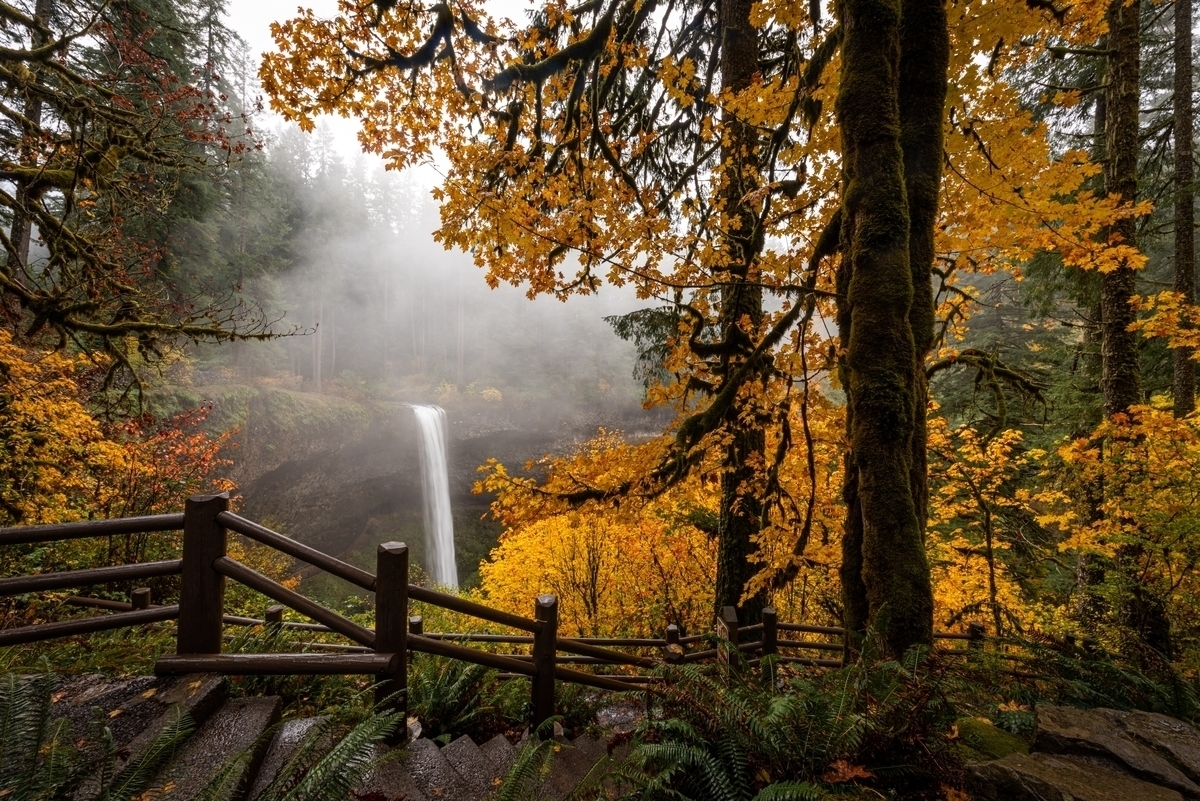
July and August are idyllic times for enjoying the warm weather of the local area. Still, the unique beauty is to be experienced in September and October when the seasons change. The changing of the leaves brings a kaleidoscope of colors – with yellow oaks, red maples, orange hickories, and even purple ashes adorning the landscape. During this time of year, it is not uncommon to witness sunrises streaked with pink that offer a beautiful beginning to each day.
As dusk approaches, brilliant oranges and deep purples accompany breathtaking sunsets. It’s no wonder this seasonal transition has long been celebrated — from festivals to bonfires — by cultures worldwide. Those who take the time to stop and appreciate nature’s majesty during these two months will find themselves rewarded with stunning views that offer a peaceful escape from everyday life.
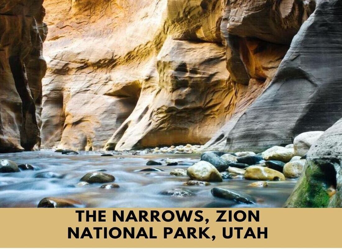
9. The Narrows, Zion National Park, Utah
How long: 15 miles
If you like to hike the Narrows in one day, be prepared for a strenuous journey. The average time it takes to hike from the top down is 10 to 13 hours, but it is best to allow 12 hours for rest breaks, photos, and meals. A permit is necessary to make this hike.
Zion National Park is a trendy travel destination in the United States. Every year, millions of people visit Zion to see its unique rock formations, hike its trails, and raft its rivers. One of the most popular attractions in Zion is the Narrows, a deep and narrow canyon carved over thousands of years by the Virgin River.
Visitors can hike through the Narrows from top to bottom or stroll along the Riverside Walk. No matter how you experience the Narrows, it’s sure to be an adventure you’ll always miss. So round up your friends and start planning your next trip to Zion National Park.
How much does it cost to hike the Narrows at Zion?
Located at the Temple of Sinawava Trailhead, The Narrows is one of the most picturesque and iconic sites in Zion National Park – boasting sheer canyon walls that soar up to 2,000 feet (610 meters) on either side. To access this incredible feat of nature’s beauty, you must have a valid park pass – which costs $35 per vehicle.
Once you’ve acquired your pass, set off for an unforgettable adventure through The Narrows – one of the most beautiful and exciting hikes in all of Zion. Along with its towering cliffs and lush greenery, you’ll be immersed in a river-carved canyon with massive sandstone walls that make for fantastic views as you wade your way upstream.
You must bring plenty of water and sturdy shoes, as parts of this hike require trekking through knee-deep pools and slippery rocks. And remember your camera! With its captivating beauty, The Narrows will surely provide some awe-inspiring photo ops!
What is the best month to hike the Narrows?
The Narrows is a renowned trekking experience through the Virgin River that requires hikers to wade in knee-deep waters. Unfortunately, due to the frigid water temperatures and perilously high levels during colder months, it is unsafe to hike The Narrows between November and May. From the end of May until October, however, The Narrows can provide an awe-inspiring journey full of breathtaking views – but caution should be taken since summertime thunderstorms can bring sudden and potentially lethal floods.
Therefore, visitors should remain vigilant while navigating The Narrows trail as they take in the majestic scenery and traverse sections of the shallow river while walking along its sandy floor. It is highly recommended that hikers plan their visit during late spring or early summer when temperatures are pleasant, and the potential for flooding risks have decreased considerably.
10. Angels Landing, Zion National Park, Utah
How long: 5 miles
The Tongass National Forest is famous for being the largest national forest in the United States. It is located in Southeast Alaska and is known for its unique opportunities to view eagles, bears, spawning salmon, and breathtaking vistas of “wild” Alaska.
Located in Zion National Park, Angels Landing is one of Utah’s most popular hiking trails. The trailhead is located at the Grotto Picnic Area, and the hike to the top of Angels Landing is approximately 5 miles round trip. Along the way, hikers will enjoy stunning views of the Virgin River and Zion Canyon. The trail is steep and narrow in places, so it is essential to be prepared for a challenging hike. However, the effort is well worth it, as the views from the top of Angels Landing are breathtaking. Hikers should also be aware that the trail can be very crowded during peak travel times, so it is better to start early in the day. With its beautiful scenery and challenging terrain, Angels Landing is a must-do for any visitor to Zion National Park.
How difficult is the Angels Landing hike?
This hike is no walk in the park! It is a highly strenuous physical endeavor that may require you to confront changing weather conditions. Before taking on this climb, it’s essential to ensure you are in great physical shape – only attempt it if you are. Not only could this be dangerous for an adult, but it is also even more so for children or anyone trying to carry a child in any form of pack or harness.
Make sure you’re well-prepared physically and mentally before attempting this challenging endeavor.
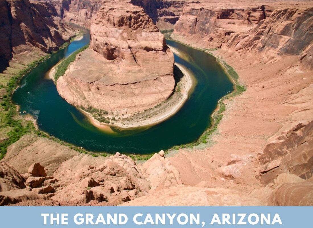
11. The Grand Canyon, Arizona
How long: 277 miles
The Grand Canyon is a large, deep canyon located in Arizona. It is known for its impressive size and the vast amounts of erosion that have occurred over time.
It is one of the most stunning examples of how erosion can change the landscape. The immense canyon was created by the Colorado River cutting through the rocks and averages 4,000 feet deep. At its deepest point, it is 6,000 feet deep and stretches 18 miles wide.
With its stunning landscapes and wealth of opportunities for adventure, it’s no surprise that so many people flock to this amazing place every year. If you’re planning a travel to the Grand Canyon, you should keep a few things in mind:
- Bring plenty of water and sunscreen; the Arizona sun can be brutal.
- Hiking is a perfect way to see the canyon, but wear appropriate footwear and take plenty of breaks.
- Remember that the canyon is sacred for many Native American tribes; be respectful of their culture and traditions.
With these tips in mind, you will have an unforgettable Grand Canyon experience.
What are the best months to visit the Grand Canyon?
Visiting the Grand Canyon can be a perfect way to beat the heat during springtime. The temperatures in the park are mildest between April and June, with average low rainfall and not too-high temperatures, making it a great time to explore the area without being too uncomfortable. However, visitors should remember that they may encounter more crowds around June when school is out of session.
To avoid large groups of people, potential visitors should plan their trip earlier to make the most out of their experience. During this period, hikers and campers will find that they can enjoy all the Grand Canyon offers without having to contend with extreme temperatures or an abundance of rainfall.
12. Bryce Canyon National Park, Utah
How long: 60 miles
Bryce Canyon National Park is well-known for its impressive collection of hoodoos and strange rock formations found in the park. Horseshoe-shaped amphitheaters and scenic vistas are also popular tourist attractions in Bryce Canyon. What’s more, the night sky makes the park a great place to view the stars.
Bryce Canyon National Park is also a popular destination for friends and adventure seekers. The rock formations in this park are unlike any others and were formed millions of years ago by erosion. Visitors to the park can explore the canyon by hiking, horseback riding, or taking a scenic drive. Several lodges and campgrounds make the park a perfect destination for a weekend getaway.
Whether you’re looking for a short-day trip or a more extended vacation, Bryce Canyon National Park is sure to provide an unforgettable experience.
Do you need a reservation to visit Bryce?
Visiting Bryce Canyon National Park does not require you to make prior arrangements or purchase a ticket well in advance. However, it is still necessary to cover the associated entry costs or present a valid national park pass to gain admittance. The entrance fee for entering the park is small but plays a vital role in providing services and amenities like trails, campgrounds, interpretive programs, park rangers, and more.
Can you drive your car to Bryce Canyon?
If you’re looking to take in the spectacular beauty of Bryce Canyon National Park without having to embark on a challenging hike, auto touring is an effortless way to experience its most impressive views. With minimal effort and no need for strenuous activity, visitors can appreciate the park’s iconic overlooks by simply getting out of their car and taking a stroll along the pathways leading to the very edge of the pavement.
In addition, this short tour provides guests with an exceptional opportunity to witness breathtaking panoramas of majestic mountainscapes, red-hued cliffs, and colorful rock formations, all of which contribute to making this national park one of Utah’s most visited attractions.
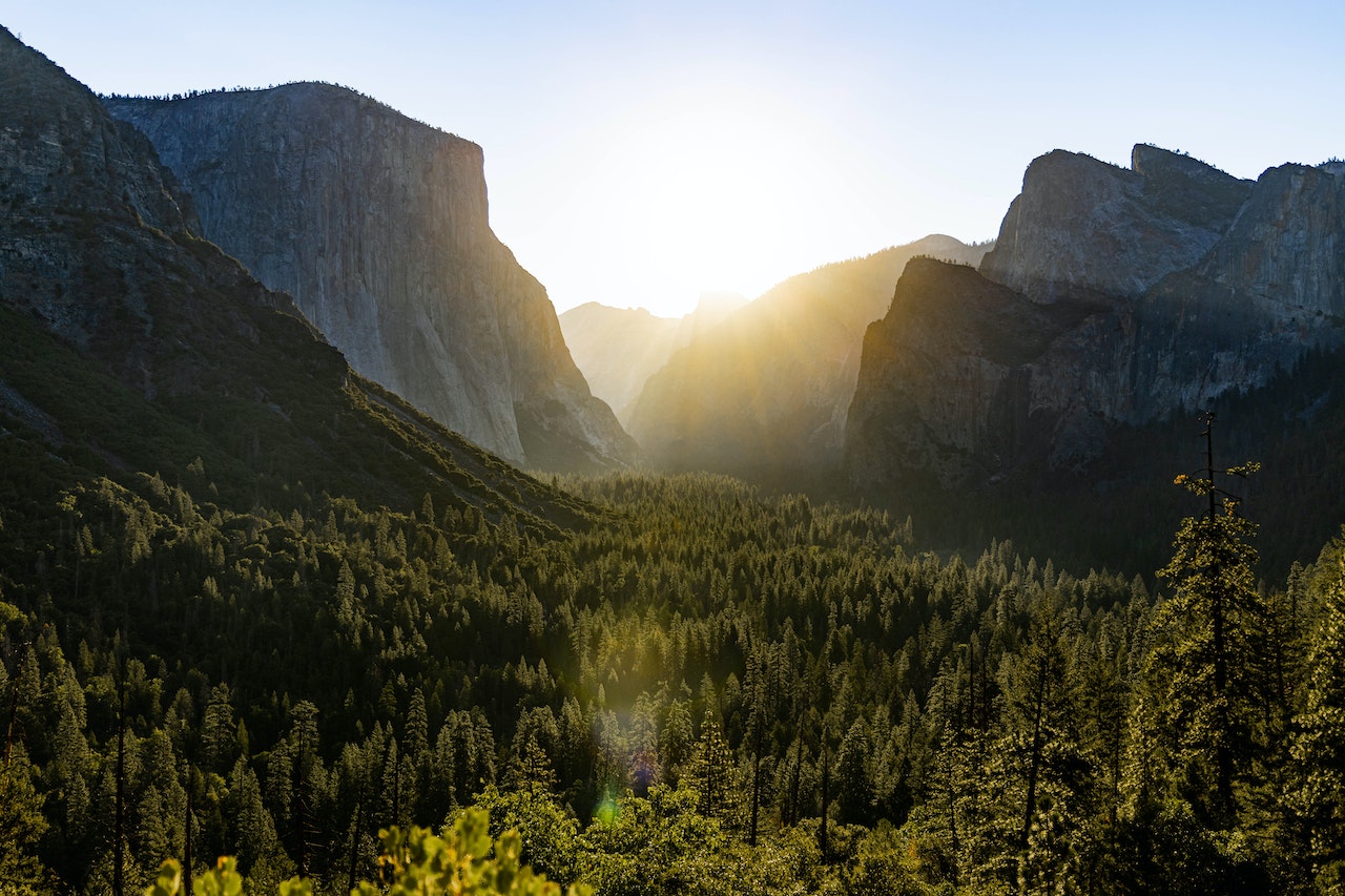
13. Yosemite National Park, California
How long: 8 miles
While Yosemite is famous for its waterfalls and tall granite cliffs, the deep valleys and ancient sequoias are also worth visiting. Organized as a national park in 1890, Yosemite continues to impress visitors with its natural wonders.
Traveling with a small group of friends or family members is the best way to explore Yosemite National Park. This will allow you time at your own pace and create unforgettable memories! Whether they travel by car, motorcoach ( Coach), bicycle, or horseback riding – everyone has their own story from this beautiful place called “Yosemite.”
How many days do I need to visit Yosemite National Park?
Visiting Yosemite National Park can be a rewarding experience, and one day is certainly enough to take in the sights of Yosemite Valley. However, if you want to make the most of your experience, it’s recommended that you stay for at least two or three days. This allows you to take longer hikes, explore Glacier Point and the Tioga Pass, and take in many of Yosemite’s inspiring landscapes.
If you’re feeling particularly adventurous, numerous activities like rock climbing and mountain biking are available to visitors. On top of this, there’s a wide range of accommodation options available onsite, so you can truly immerse yourself in nature during your stay. With all this in mind, spending two or three days at Yosemite National Park is an ideal amount of time to enjoy all this stunning area has to offer!
Where do you fly to get to Yosemite?
Commercial Airports Near Yosemite
- Merced Airport (MCE)
- Fresno-Yosemite International (FAT)
- Mammoth Yosemite Airport (MMH)
- Stockton Metropolitan Airport (SCK)
- Oakland International (OAK)
- Sacramento International (SMF)
- San José International (SJC)
- San Francisco International (SFO)
How is the drive from San Francisco to Yosemite?
Visiting Yosemite National Park from San Francisco is a short and easy drive, about 170 to 200 miles, depending on your route. It doesn’t take very long, especially given the context of California’s roads — aside from the long drive from Los Angeles to the park, trips elsewhere within the state don’t typically require more than five hours.
One can easily plan for a single-day excursion with an early start to make it to Yosemite and back in time. The journey provides beautiful sights of northern parts of California along the way, including cities such as Stockton, Modesto, Turlock, and Merced. At the same time, some routes may include crossing into other nearby states like Nevada or Oregon. There are plenty of gas stations and restaurants at regular intervals if you need to fill up or grab a snack during your trip.
Additionally, consider bringing supplies such as extra water bottles and snacks since these items may be limited onsite due to Covid-19 health regulations. With some planning and preparation, it’s easy to have a safe and enjoyable experience visiting one of America’s most iconic national parks from San Francisco!
Do you need a reservation to walk into Yosemite?
There is no fee for a reservation or permit to visit Yosemite. However, if you are planning to spend a night in Yosemite National Park, it is highly recommended that you make a lodging or campground reservation. This is especially essential if you plan to visit during peak season, as this will ensure you have an allocated place to stay. Without a reservation, there is no guarantee that accommodations will be available.
Additionally, visitors are encouraged to obtain camping permits when planning overnight trips into the backcountry. The entrance fees vary depending on the type of pass selected and whether it was purchased in advance or at the park entrance gate. When purchasing tickets, visitors should know that separate admissions may be required for some attractions, such as guided tours or special events. All prices are subject to change, so it is best to check the official website before making any purchases.
Related Article: 15 Top Things to do in Yosemite National Park
14. Kings Canyon National Park, California
How long: 25 miles
Kings Canyon National Park is similar to Yosemite Valley and is home to the world’s largest sequoia tree grove! With its deep valleys, skyscraping trees, and distinctive rock outcroppings, Kings Canyon National Park rivals Yosemite Valley in beauty and grandeur.
Kings Canyon National Park is a fantastic travel destination for adventurers and nature lovers. The park is home to towering mountains, pristine lakes, and lush forests. There are various activities to keep visitors busy. Whether hiking to the top of a hill or taking a stroll through a meadow, you’re sure to appreciate the beauty of this remarkable place. And what could be more fun than exploring Kings Canyon with friends? There’s no better way to experience lasting memories than sharing an adventure in this stunning national park.
So if you’re planning an unforgettable travel experience, add Kings Canyon National Park to your list!
Where is Kings Canyon, California?
Kings Canyon National Park is a stunning slice of nature in east-central California’s Sierra Nevada mountain range. It is located beside Sequoia National Park and is managed by the same governing body, while Yosemite National Park lies just 64 kilometers or 40 miles to the northwest. This natural park provides visitors with peaceful surroundings, interesting geological features, and countless opportunities for outdoor recreation.
Is Kings Canyon worth visiting?
The landscape of this territory includes several picturesque canyons, including an impressive gorge known as Kings Canyon that extends for over 8,200 feet at its deepest point. The park also contains many peaks that reach well above the 9,000-foot mark, so several hiking trails are available for those wishing to explore its hilly terrain.
Furthermore, Kings Canyon National Park offers glimpses into the past with archaeological sites that date back more than 3,400 years ago.
What activities can be done in Kings Canyon, California?
Apart from its beautiful scenery and history, this park also offers numerous activities that can be enjoyed throughout the year. Visitors can enjoy camping trips under starlit skies or hike through shady areas along a bubbling creek in the summer.
Winter brings snowfall, opening up fun activities such as skiing and snowshoeing on untouched powdery slopes. Bird-watching tours occur on spring evenings as woodpeckers flutter among elm trees and blue herons wade through shallow waters.
No matter what time of year it is, Kings Canyon National Park remains a popular destination for sightseers from all around the world looking to spend time surrounded by natural beauty and partake in some of its many recreational activities.
15. Sequoia National Park, California
How long: 631.3 square miles
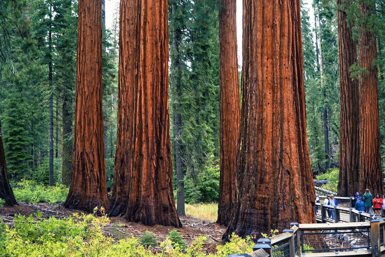
Sequoia National Park is unique because it was the first park created to protect a living organism. The massive sequoia trees that grow there can only be found in the unique environment of the western Sierra, at elevations between 5,000 and 8,000 feet.
Sequoia national park has been a popular travel destination in California since it was first established. Visitors see the giant sequoias, which boast some of the largest diameters anywhere on Earth and include giants like the “Indian Tree,” with an estimated height over Guangzhou Tower (responsible for more than one percent of all global rainfall). The park houses several other species of smaller plants & animals too!
You can enjoy hiking or camping here-or. Take one scenic drive along winding roads through this incredible natural beauty spot.
Can you drive through Sequoia National Park?
Visitors can traverse between Sequoia and Kings Canyon National Parks along the General’s Highway during the warmer months, generally from spring to fall. The road between the two parks may be closed due to hazardous winter conditions, though both parks remain open all year round. This route provides a scenic drive with plenty of opportunities to catch glimpses of the area’s majestic redwoods and breathtaking views of several nearby mountain peaks.
What activities can be done in Sequoia National Park?
There are numerous outdoor activities that visitors can take advantage of, such as picnicking, camping, fishing, and hiking.
Conclusion
From the well-known Appalachian Trail to the Kings Canyon, there is a hike for everyone in the United States. With this list of the 15 best hikes in the US, we hope you will be encouraged to get outdoors and explore America’s beautiful landscape.
Have you hiked any of these trails? What was your experience like? Let us know in the comments below!
Popular Article: