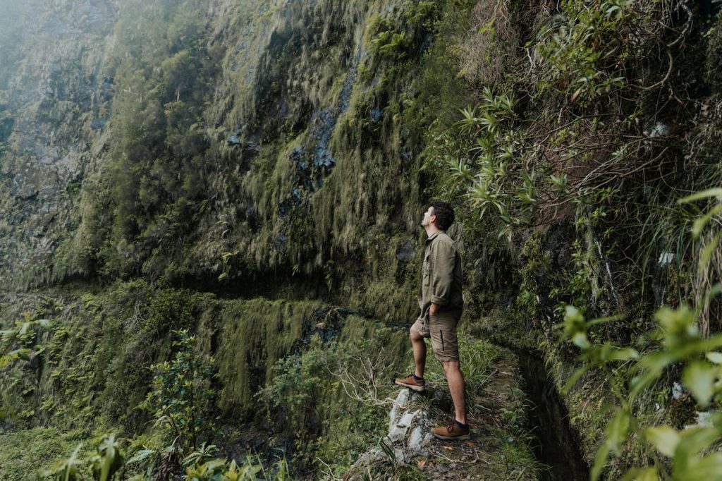
Hey there, nature lovers! Are you ready to discover the stunning wonders of Big Sur? Nestled along California’s rugged coastline, Big Sur is a paradise for hikers and outdoor enthusiasts. In this article, we’re about to embark on an exciting journey through the “10 Best Trails in Big Sur.” Each trail has unique charm, from misty seaside cliffs to serene redwood forests.
Whether you’re a seasoned hiker or just looking for a peaceful stroll, Big Sur has something special for everyone.
So, lace up your boots, pack your spirit of adventure, and let’s discover these amazing trails together!
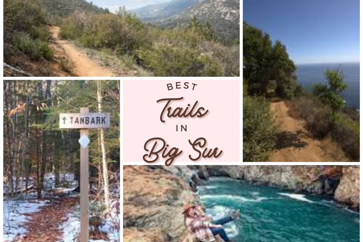
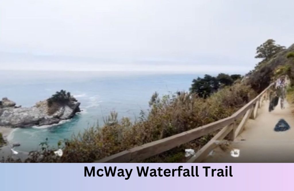
1. McWay Waterfall Trail – Big Sur California
Specialty of the Trail
The Big Sur Monterey California Coast trail to McWay Falls is known for its stunning coastal views and the iconic McWay Falls. This 8-hour private charter excursion is ideal for those who want to experience the breathtaking beauty of the California coast in Big Sur.
Best Time to Visit
The trail is most enjoyable in late spring to early fall when the weather is warm and clear skies. This period offers the best conditions for experiencing the majestic views of McWay Falls and the surrounding coastline.
However, its beauty can be appreciated year-round.
Modes of Transportation Available
The tour typically starts from San Jose; transportation is usually part of the private charter package. Visitors can reach the trail by car, with parking available near the trailhead. There are no public transportation options directly to the trail, but it’s a popular stop for those driving along Highway 1.
Directions
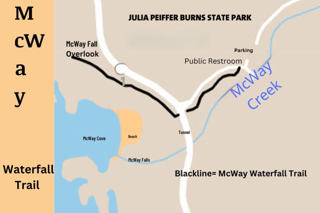
The trailhead is located in Julia Pfeiffer Burns State Park, about 37 miles south of Carmel. It’s easily accessible from Highway 1, with clear signage leading to the parking area.
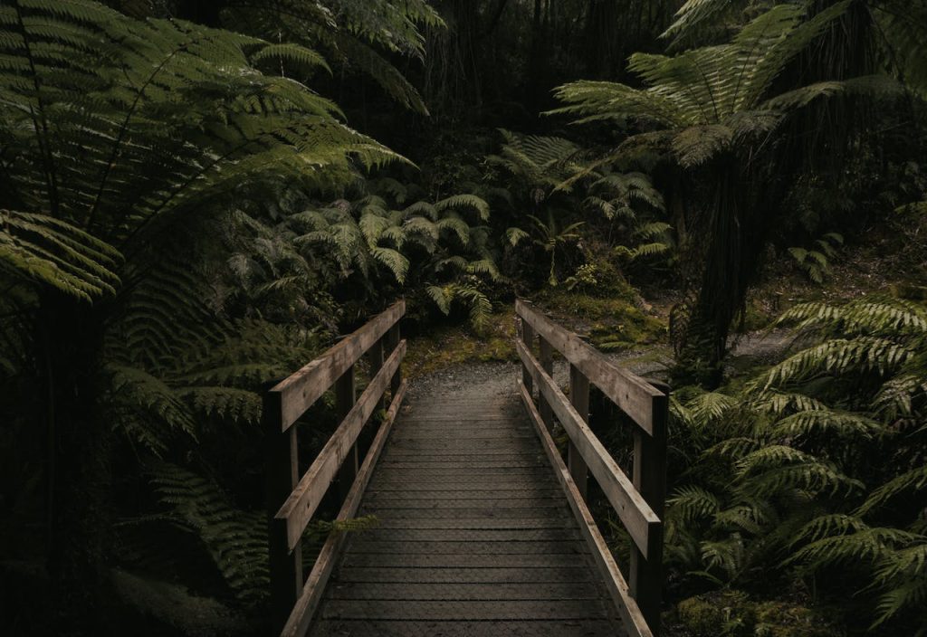
2. Ewoldsen Trail – Big Sur California
Specialty of the Trail
Ewoldsen Trail is one of the best trails in Big Sur. It is a moderate to challenging hike that takes you through lush redwood forests, offering glimpses of the ocean and canyon views. The 4.5-mile loop is well-loved for its diverse scenery and the opportunity to immerse in nature.
Best Time to Visit
Spring and fall are ideal for hiking the Ewoldsen Trail, as the temperatures are comfortable, and the trail is less crowded. The beauty of the redwoods is a year-round attraction, though.
Modes of Transportation Available
The trail is most commonly accessed by car. There’s a parking area at Julia Pfeiffer Burns State Park, where the trail begins. Public transport options are limited in Big Sur.
Directions
Located in Julia Pfeiffer Burns State Park, the trailhead starts at the park’s main parking area. It’s about 37 miles south of Carmel on Highway 1.
3. Partington Cove Trail – Big Sur California
Specialty of the Trail
Partington Cove Trail is a short but steep 1-mile round trip hike. It leads to a beautiful cove and a historic tunnel. The trail offers a mix of coastal views, dense forest, and a peek into Big Sur’s history.
Best Time to Visit
The trail is accessible and enjoyable all year, but the best time to visit is during spring and fall for the most comfortable hiking conditions.
Modes of Transportation Available
Access to Partington Cove Trail is primarily by car. There’s a small parking area off Highway 1 where the trail begins. Public transportation to the trail is not available.
Directions
The trailhead is located off Highway 1, about 60 miles south of Carmel. Look for a small turnout on the west side of the highway, marked by a gate.
4. Tanbark Trail – Big Sur California
Specialty of the Trail
Tanbark Trail is known for its challenging terrain and rewarding views. This 6-mile round-trip hike takes you through dense redwood forests and offers stunning vistas of the coast. It’s a great trail for experienced hikers.
Best Time to Visit
Late spring through early fall is the best time to hike Tanbark Trail, as the weather is more predictable and the trail is less muddy.
Modes of Transportation Available
The trail is accessible by car, with parking available near the trailhead at Julia Pfeiffer Burns State Park. There are no public transportation options directly to the trail.
Directions
The trailhead is located near the entrance of Julia Pfeiffer Burns State Park, about 37 miles south of Carmel on Highway 1.
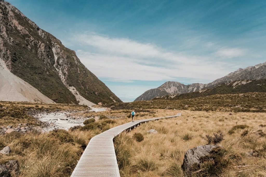
5. Pine Ridge Trail – Big Sur California
Speciality of the Trail
Pine Ridge Trail is a popular backpacking trail in Big Sur, stretching 19.5 miles through the Ventana Wilderness. It’s known for its challenging terrain, stunning views, and access to Sykes Hot Springs.
Best Time to Visit
The best time for this trail is from late spring to early fall, when the weather is warmer and the days are longer. Winter and early spring can be tricky due to rain and colder temperatures.
Modes of Transportation Available
The primary mode of transportation to Pine Ridge Trail is by car. The trailhead is located at Big Sur Station, where parking is available. Public transportation options are limited in this area.
Directions
Pine Ridge Trail begins at Big Sur Station, located on Highway 1 in the heart of Big Sur, approximately 26 miles south of Carmel. The station is well-signed and easy to find.
6. Buzzards Roost Trail – Big Sur California
Speciality of the Trail
Buzzards Roost Trail is a delightful hike that offers a bit of everything – from lush forests to panoramic views of the Pacific Ocean. This moderate 3-mile loop is perfect for those who want a taste of Big Sur’s natural beauty without a full-day hike.
Best Time to Visit
The trail is lovely year-round, but the best time to visit is during spring and fall when the weather is mild and the views are clear.
Modes of Transportation Available
The most common way to get to Buzzards Roost Trail is by car. There’s parking available at Pfeiffer Big Sur State Park, where the trail starts. There are a few options of public transportation in Big Sur.
Directions
The trailhead is located in Pfeiffer Big Sur State Park, just off Highway 1. It’s about 26 miles south of Carmel. The park is well-signed, making it easy to find.
7. Valley View Trail – Big Sur California
Speciality of the Trail
Valley View Trail is a short but rewarding hike known for its stunning views of the Big Sur Valley and the surrounding mountains. This 2-mile round-trip trail is relatively easy and suitable for most fitness levels.
Best Time to Visit
You can enjoy Valley View Trail throughout the year, but the best times are during spring and fall for the most comfortable hiking conditions and vibrant scenery.
Modes of Transportation Available
Access to Valley View Trail is typically by car. Parking is available at Pfeiffer Big Sur State Park. There are few public transport options available to reach the trail.
Directions
The trail begins at Pfeiffer Big Sur State Park, located on Highway 1, about 26 miles south of Carmel. The park entrance is clearly marked.
8. Bluff Trail – Big Sur, California
Speciality of the Trail
Bluff Trail is an easy, scenic trail that runs along the coastline, offering stunning ocean views and the chance to spot wildlife. This flat trail is about 2 miles long and is perfect for a leisurely walk or a family outing.
Best Time to Visit
Bluff Trail is enjoyable all year round, but the best time to visit is during spring and summer when the weather is warmer and the days are longer.
Modes of Transportation Available
The trail is most commonly accessed by car, with parking available at Andrew Molera State Park. Public transportation to this area is limited.
Directions
Bluff Trail is located in Andrew Molera State Park, about 22 miles south of Carmel on Highway 1. The park is well-signed and easy to locate.
9. Soberanes Canyon Trail – Big Sur, California
Speciality of the Trail
Soberanes Canyon Trail is a stunning hike that takes you through a lush canyon and up to a ridge with spectacular coastal views. This 4.7-mile loop trail is a bit challenging but incredibly rewarding, with its diverse landscapes, including redwood groves and wildflower fields.
Best Time to Visit
The ideal time to hike Soberanes Canyon Trail is during the spring when the wildflowers are in bloom or in the fall when the weather is cooler and the trail is less crowded.
Modes of Transportation Available
The primary way to access Soberanes Canyon Trail is by car. There is a parking area near the trailhead on Highway 1. You will find limited public transportation options in this region.
Directions
The trailhead is off Highway 1, about 7 miles north of Big Sur Village. It’s well-marked and relatively easy to find, located near the entrance of Garrapata State Park.
10. Pfeiffer Falls Trail – Big Sur California
Speciality of the Trail
Another great option for hikers in Big Sur is the Pfeiffer Falls trail, which takes you through a beautiful redwood forest and past several smaller waterfalls before reaching the main attraction: a 60-foot cascading waterfall. The hike to the falls is moderate in difficulty and offers a peaceful and serene experience for those who take it.
In addition to its many trails, Big Sur is also home to several scenic lookouts and overlooks where hikers can stop to take in the breathtaking views of the Pacific Ocean. The Bixby Bridge, for example, offers stunning views of the ocean and the surrounding coastline and is a popular spot for photography.
Best Time to Visit
The trail is beautiful throughout the year, but the best time to visit is spring when the waterfall is at its fullest and the surrounding greenery is vibrant. Fall also offers a pleasant hiking experience with cooler temperatures and fewer crowds.
Modes of Transportation Available
The most common way to access Pfeiffer Falls Trail is by car. Parking is available at Pfeiffer Big Sur State Park, where the trailhead is located. This area has limited public transportation.
Directions
Pfeiffer Falls Trail is one of the best trails in Big Sur and located in Pfeiffer Big Sur State Park, on Highway 1, approximately 26 miles south of Carmel. The park entrance and the trailhead are well-marked and easy to find.
Conclusion: The 10 best trails in Big Sur
And there you have it – the 10 best trails in Big Sur that promise an unforgettable adventure. Whether you wandered through the ancient redwoods or stood awe-struck by the ocean views, each trail in Big Sur has left us with lasting memories and stories to share. Remember, the adventure along the way is as significant as the endpoint itself.
So, take your time, breathe in the fresh air, and embrace the natural beauty around you. We hope this guide inspires you to explore these magnificent trails and create your own unique experiences in the great outdoors. Until your next hiking adventure, keep exploring and stay wild at heart!
The Ultimate Guide to Big Sur: California’s Coastal Haven
15 Best Hikes in the US | Your Guide to America’s Greatest Trails
Exploring the Majestic Alabama Hills: A Hidden Gem in California’s Landscape